Maps
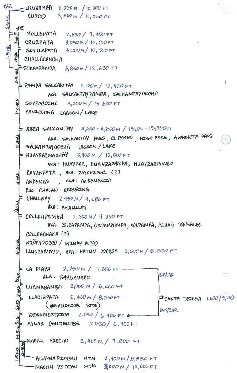
This is a *theoretically* comprehensive list of towns/villages/points along the Salkantay Trek:
The list above has been combined from various tour itinerary descriptions and maps available online. The travel times are consistent with our experience; however do keep in mind - everyone walks at a different pace.
-----------------------------------------------------------------------------------
The one single thing I wish I had during our travels is a GPS, so I will have to resort to records of others for a true visual of the Salkantay Trek to accompany our blog.
Thanks to "jwheidmeijer" of gpsies.com for his record of the Salkantay Trek:
----------------------------------------------------------------------------
According to other sources this map for $25 includes the full Salkantay Trail GPS trek:
http://gpstravelmaps.com/sacredvalley.php
Some best free maps I found online:
One of the few (if not the only) accurate and mostly comprehensive treks laid out on a scaled, almost topo map. (Follow the left most trek - this is the "Alternative Salkantay"; Inka Trail is on the right):
A minimal representation of the trek on an accurate scaled map:
This map is one of the first results in Google and is pretty good, however note that you should NOT rely on the scale to judge distances, ie: Lucmabamba is actually only ~30 min walk from La Playa while the distance on the map is huge:
This is a typical map you will find at tour agencies, mostly useless other than examining distances between indicated overnight camping locations:


